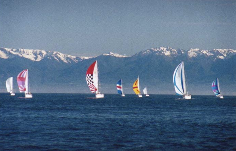
Leg Descriptions
| Leg 1 Date: June 14, 2003 Course: Nanaimo to French Creek Distance: 22.10 nautical miles Link to the progress of Leg 1 Start: 1030 hrs – The race committee will be on station on the Visiting Vessels Pier in Nanaimo harbour. Boats will start in the harbour between the pier and the satellite reef marker. All boats start together. Excellent spectator viewing from the Visiting Vessels Pier. A running commentary and introduction of boats will be broadcast via a PA system on the visiting vessels pier. Boats are asked to participate by sailing close by the pier for an introduction to the spectators during pre-race warm-up. Special Notes: This is a very busy harbour. Use Caution. Expect heavy ferry traffic off Nanaimo. Area Whiskey Gulf will not be active over the weekend. Finish Line French Creek: The finish is near the southernmost breakwater in French Creek between the race committee motor home onshore and an inflatable marker. Excellent spectator viewing. The entrance to the harbour is tight with a nasty dogleg going in. Finish Time: The drop-dead finish time is 1800 hrs on all legs up the inside. Depending on wind boats may finish this leg anywhere between 1230hrs and 1800 hrs. Moorage has been “sponsored” courtesy of the French Creek Harbour Authority. Harbour Master, Julie Blood, and others will be on hand to provide assistance with tying up. Rafting will be necessary at this and most other stops. The Lasqueti Island Ferry Dock is located here. Awards Presentation: An informal awards presentation will be held as soon as the results are calculated. All boats will be presented with a flag bearing the name of the town with the winners receiving different coloured flags. This will be repeated at all stops. Facilities: Accommodations/Fuel/Showers/shore power/laundry/water/small store, etc at the head of the dock. Major grocery stores located in Parksville a 10-minute drive away. Festivities: The manager of the French Creek Resort and Boar’s Head Pub, Russ Mosher, has lined up some great entertainment and festivities. More details will be posted at a later date. Call the French Creek Resort for more information 250-248-3713 Original article (Click Here). |
| Leg 2 Date: June 15, 2003 Course: French Creek to Comox Distance: 28.55 nautical miles Link to the progress of Leg 2 Start: 0900 hrs. The start is off the French Creek Marina breakwater. Excellent spectator viewing from the breakwater. Finish: As the tides are low at the Comox Bar the finish will be a line extending across the bar allowing boats to finish on either side of it. Refer to the sailing instructions for accurate description of all finishes. The Comox Valley Yacht Club will provide assistance with the finish lines and times. See this link for a chart of the Comox Harbour Moorage: Moorage has been sponsored by the Comox Marinas in beautiful downtown Comox. Boats will be escorted to their slips courtesy of the Comox Valley Yacht Club and will need to raft. See this link for a map of the marina and downtown. Awards Reception: An awards reception will be held at the Comox Valley Yacht Club above the Edgewater Pub located at the head of the dock, organized by the Comox Valley Yacht Club and Okanagan Spring Brewery.. Great views of the harbour and the famous Comox Glacier from the Yacht Club. A BBQ is currently being organized and the venue and cost will be announced at a later date. Facilities: Fuel, Water, power, marine pump out station, Showers, Laundry, parking, restaurants, pubs, shops, etc. all available and close. Accommodations: There are limited hotels in the immediate vicinity, see host city link. Lots of accommodations in Courtenay – a 10 min drive away. Festivities: TBA Original article (Click Here). |
| Leg 3 Date: June 16, 2003 Course: Comox to Campbell River Distance: 23.90 nautical Link to the progress of Leg 3 Miles start: 0800 hrs. The start is outside the Comox Bar. The sand bar not the pub/bar. The water is a little thin through here. Finish: Due to the strong currents coming down Discovery Passage, we are unable to finish in town. The finish will be near the P60 buoy at Wilby Shoals south of Cape Mudge on Quadra Island. Moorage: The Riptide Pub and Marina has once again sponsored your moorage at the Riptide Marina in Discovery Harbour. Discovery Harbour is located immediately north of the Quadra Island Ferry Terminal. Escort boats will be on hand to escort you to your slip with lots of assistance to tie up. Rip Tide Marina monitors Channel 68. Visit their website www.riptidepub.com for more information. Awards Reception: An informal awards reception and dinner will be held at or immediately adjacent to the Riptide Pub at the head of the docks, shortly after 6:00 pm. Accommodations: Race Sponsor, The Coast Discovery Inn and Marina, is located in the immediate vicinity a five minute walk from the Riptide. Refer to the Welcome Packages sent from Campbell River and host city link for more information on accommodations. Facilities: Excellent shower and laundry facilities at the head of the dock. Fuel, water, shore power, ice, groceries and shopping are close at hand. Stock up here, as this is the last stop for provisioning before Port Hardy.Boxed Lunches are available from the Riptide, a nice option considering the very early morning departure. Order forms will be available the evening before. Special Notes: This leg is where the tides meet. The tidal stream entering the strait around the SE of Vancouver Island meets the corresponding tide that flows around the NW end of the island between Cape Mudge and Cape Lazo. The tide floods South north of Middlenatch Island and floods North, south of Middlenatch Island. Because of this it makes no matter what time of the day this leg is started, the current will be against you at some point, guaranteed. Cautionary Note: Between Cape Mudge and Willow Point there is a heavy race on south-going streams, which when opposed by strong SE winds sets up short steep swells and a very rough sea condition. Original article (Click Here). |
Leg 4
Date: June 17, 2003
Course: Deepwater Bay to Hardwicke Island
Distance: 24.50 nautical miles Link to the progress of Leg 4
Start: 0830 hrs. The starting area is in Deepwater Bay 12 miles north of Campbell River. Boats will need to leave the docks early to get through Seymour Narrows to make the start. The committee boat will be on station in Deepwater Bay on Quadra Island.
Seymour Narrows is the main shipping channel for all traffic heading to or coming from the North. The currents through Seymour can get up to 16 knots.
Finish: The finish is off Eden Point in Chancellor Channel. The race committee boat will be on station on the finish line. Brisk Northwest winds are common this time of year and this is usually a fast leg.
Moorage: Moorage has been sponsored courtesy of the Omega Salmon Farm located approx. 1 nm. from the finish line in Chancellor Channel near Hardwicke Island. Assistance will be available to tie up at the pens.
Facilities: Other than safe, secure moorage and generous hospitality there are no facilities or accommodations here and no shore access. Boats need to be totally self sufficient at this stop.
Awards Reception/BBQ: TBA. Due to liability concerns no alcohol is permitted on the pen system.
Original article (Click Here)
| Leg 5 Date: June 18, 2003 Course: Hardwicke Island to Telegraph Cove Distance: 40.30 nautical Link to the progress of Leg 5 MilesStart: 0730 hrs. The start is in the vicinity of the previous finish line. This is a tricky leg for playing currents. Light winds and fog are common in early morning with brisk winds generally filling in after noon. This leg is started early to take full advantage of the positive current and hey there are no Tim Hortons here, so may as well go sailing. Finish: The finish is between the entrance to Telegraph Cove and Lewis Point. The Race Committee Motorhome will be on station at Elia Point. Excellent spectator viewing. Moorage: Moorage is “sponsored” at the Telegraph Cove Resort & Marina, courtesy of Gordie Graham of Telegraph Cove Resort. Moorage for the fleet here will be extremely tight. Boats will be assigned a spot with assistance from Jim Borrowmen. Some boats may be assigned a spot at the docks in Beaver Cove. These docks have easy access to Telegraph Cove. If you prefer to make your own arrangements you can call the new docks across from Old Telegraph Cove at 250-928-3163 where moorage is available at a cost. Facilities: Telegraph Cove Cabins and RV Park, Water/Showers/Laundry and Gas are close at hand. No Diesel. There is also the Old Saltery Pub & Restaurant, a confectionery and souvenir shop on the dock. Further accommodations and amenities can be found in Port McNeil a 30 min drive North. See www.telegraphcoveresort.com Awards Reception: There will be a barbecue, for the racers organized by the small business community of “The Cove” immediately following the awards. Excellent food also available at the pub & restaurant. Special Notes: This leg is voted the most likely not to finish but the scenery is awesome and takes you past Robson Bight the famous killer whale rubbing beach.For those interested in whales and whale bones Jim Borrowman, is a wealth of knowledge and opened a whale interpretation center on the boardwalk here in summer 2002. Nicknamed the ‘Bones Project’, there are lots of neat whale bones on display.Proceeds from the BBQ will go towards the Johnstone Strait Whale Interpretation Center. Original article (Click Here) |
| Leg 6 Date: June 19, 2003 Course: Telegraph Cove to Port Hardy Distance: 28.10 nm Link to the progress of Leg 6 Start: 0800 hrs. The start will be in the same area as the previous finish. Excellent Spectator Viewing. Finish: The finish is in Hardy Bay where the race committee will be on station on the Government Dock. Excellent spectator viewing. Moorage: Moorage is “sponsored” at the “Summer Floats” adjacent to the Government Dock the first docks you come to arriving by sea, (see charts mailed to you from Port Hardy) courtesy of the District of Port Hardy. The Government Dock is located at the end of Granville Street right downtown. Refer here for a map www.ph-chamber.bc.ca/map4.html Facilities: Fuel is available here however there is no shore power on these docks and water is at the head of the dock. Shower facilities and a refreshing swim are provided courtesy of the District of Port Hardy at the Swimming Complex a short walk away. Laundry, Groceries and other amenities are close by. Check the Port Hardy Host City web site for accommodations Awards Reception: Awards and BBQ at the head of the dock in Carrot Park. Festivities: The mayor of Port Hardy, Harry Mose, and District Administrator, Rick Davidge, are planning some great entertainment, mostly with a native them, to take place in Carrot Park. Details to TBA, or call the District of Port Hardy at 250-949-6665. Special Notes: Stock up on Provisions here. Winter Harbour has limited selection. Next stop for provisioning is Ucluelet. Original article (Click Here) |
| Leg 7 Date: June 20 – 21, 2003 Course: Port Hardy to Winter Harbour Link to the progress of Leg 7 Distance: 69.40 nautical milesStart: 0800 hrs. same as the previous finish excellent spectator viewing from the government dock.This is the first offshore leg and takes sailors around the top of the island, past Cape Scott to the Open Pacific. This leg is where things can get very interesting and skippers have a choice of crossing the Nahwitti Bar, at the entrance to Goletas Channel, or taking the longer outside route into Queen Charlotte Strait. Nahwitti bar has a reputation for being one of the nastiest bits of water on the coast but it can also be benign. This leg could prove extremely challenging. Finish: The race committee will be on station at the Kains Island lighthouse (Quatsino Light station) and the finish will be a transit from the lighthouse to Robson Rock 0.62NM. bearing 081 magnetic from the light house. This is the preferred entrance to Forward Inlet from the North. Kains Island is only accessible by boat (or helicopter if you happen to have one). Finish Time: Boats have until 1800 hrs on June 21 to finish this leg. In past years most boats are finished by 0800 hrs. Moorage: Is available at the B.C Packers floats just north of the flashing light on Greenwood Point (see map under Winter Harbour-Host Cities) The cost is $15/night. Overflow moorage is available at the Government Dock at Government Rates. It is wise to have Canadian cash on hand. Facilities: No Shore Power, limited showers and toilets. Fuel, water, small grocery/liquor store, laundry and pay phones are all close at hand. Accommodations are very limited. Most are already full.Frosty’s RV park has 32 sites with electricity, showers and toilets available for RV Park patrons only. Call ahead to make a reservation at 250-969-4343 or 250-288-3517. Awards Reception: The awards presentation will likely take place at the old School House. The folks of Winter Harbour and Holberg (the neighbouring community) are in the process of organizing a Hamburger BBQ, with proceeds going to help the local communities, nothing finalized as yet. Boats need to be totally self-sufficient here. Special Notes: Driving to Winter Harbour from Port Hardy is 76 km. via a gravel logging road, through Holberg. There is ‘A’ restaurant/pub in Holberg called the Scarlet Ibis. The logging roads are active Monday to Friday until 6:00 pm. It is recommended that you wait until after this time to drive in past Holberg. There may be some activity on weekends but in any case be prepared to yield. For more information on driving in and current road conditions please call Western Forest Product’s Holberg office at 250-288-3362. A limited number of road maps will be available from Race Headquarters in Port Hardy. Carry good spare tires. Original article (Click Here) |
Leg 8
Date: June 22 – 24 2003
Course: Winter Harbour to Ucluelet
Distance: 138.10 nautical miles Link to the progress of Leg 8
Start: 0800 hrs Start across the previous day’s finish line. Many will opt for a longish offshore leg to avoid the turbulent waters off Brooks Peninsula. At 138 nm this is the longest leg of the race.
Finish: The race committee will be on station at the Amphitrite Point lighthouse. The finish will be from the lighthouse to the Red whistle buoy Y42. Good spectator viewing. Depending on conditions some boats may finish in daylight hours. It is more likely that this will be a night finish and the entrance to Ucluelet can be challenging especially the first time. Coast Guard Auxiliary 38 will be on hand at the finish to provide safety escorts to those who need it. This will be weather dependent and all racers should exercise extreme caution in this area.
Finish Time: Boats have until 1200 hrs on June 24 to finish this leg.
Moorage: Moorage is “sponsored” in the municipal marina “boat basin” near the Canadian Princess downtown, courtesy of the District of Ucluelet. (see the marine facilities link at www.dist.ucluelet.bc.ca/frame.html for more info.) Boats drawing more than ten feet may be required to tie up at the outer float in the same area.
Facilities: Shore power, water, fuel, showers, laundry, shopping are all available and close by. There are some first class accommodations and restaurants located in Ucluelet. The Tauca Lea Resort is a new sponsor of the race this year, and offers one and two bedroom suites, on the water a five minute walk from the marina. www.taucalearesort.com
Welcome Reception & Awards: A tasty dinner and awards presentation has been organized by the local community at the Community Hall on Tuesday June 27. Time TBA.
The Ucluelet Chamber of Commerce sends the following message to you:
“A special member of our community will meet the individual boats upon arrival. Some of our greeters vie for the same yacht year after year as they have created a special bond with the crews. The Coast Guard Auxiliary and the greeter Co-ordinator work closely together to ensure the greeters are there for arrival and docking. Each greeter welcomes the boat with special information packages which include goodies from various businesses and sometimes their own home cooked fare.
The crews and followers have a chance to experience “Life on the Edge” for a day or so while Tuesday evening always proves to be a fun and entertaining night. Ucluelet shares its West Coast Hospitality with a BBQ and award presentation.
From vantage points at Amphitrite Point and the Wild Pacific Trail, the community watches the yachts depart with a wave and a smile in anticipation of their arrival again next year.
Original article (Click Here)
| Leg 9 Date: June 25-27, 2003 Course: Ucluelet to Victoria Distance: 97 nautical Link to the progress of Leg 9 MilesStart: 1000 hours. The start line is in the vicinity of the previous day’s finish. Excellent spectator viewing from Amphitrite Point.Finish: The finish will be similar to the “Swiftsure” harbour finish inside the breakwater in Victoria harbour. The race committee motor home will be on station at the Ogden Point Docks. Moorage: Moorage will be available in Victoria’s Inner Harbour at the Empress Floats (Government St. Floats) in front of the Empress Hotel and Parliament Buildings downtown. Refer to this link www.victoriaharbour.org/Facilities.html for location and information. Awards Presentation: An awards presentation will take place at a yet to be determined location close to the moorage facility. Facilities: Enjoy all the facilities and amenities this fantastic Capital City has to offer, everything is available and close. Special Notes: This is an extremely busy harbour with heavy float plane and ferry traffic. For information and rules on transiting Victoria’s Harbour please refer to this map www.tc.gc.ca/pacific/marine/victoriaharbourtrafficscheme.htm Follow the yellow markers. There is no sailing permitted in the harbour. Enjoy what rest you can here as you are about to start one of the most tactically challenging legs of all. Original article (Click Here) |
| Leg 10 Date: June 27 – 29, 2003 Course: Victoria to Nanaimo Distance: 60.40 nautical Link to the progress of Leg 10 MilesStart: 1500 hrs. The race committee will be on station on the Ogden Point Breakwater and the start will be between the Ogden Point Breakwater and Brotchie Ledge. Excellent spectator viewing from Ogden Point. This leg starts in the afternoon, to take advantage of the tide and to give boats the best opportunity of finishing in daylight hours on Saturday in Nanaimo.With so many routes through the Gulf Islands to Nanaimo and the traditionally fickle winds this night sailed leg will no doubt have most navigators pulling their hair out. Significant differences in the length of the various routes and tides through the many passes will prove challenging. Finish: The finish will be off the Visiting Vessels Pier in Nanaimo Harbour. Excellent Spectator viewing. Finish Time: Boats have until 0800 on June 29 to finish this leg. Moorage: Moorage will again be “hosted” by the Nanaimo Port Authority. Please contact the Harbour Master upon your arrival. Awards Party: Sunday June 29, 1130 hrs. A “Gala Awards Party” at the Newcastle Island Park Pavilion in Nanaimo harbour is currently being organized. Stay tuned for further details.* This is not an official race document and may be subject to change. In all cases refer to the Sailing Instructions. Original article (Click Here) |
Link for Afterword – Nanaimo to Sandy Point (Click Here).